categories
logos
calendar
log in
sign up
Categories PNG's
Famous PNG Logos
Events Calendar
Popular PNG's
Newest PNG's
PNG's by Color
AI Background Remover
AI Image Editor
Help / FAQ
User ryann2k1 uploaded the image
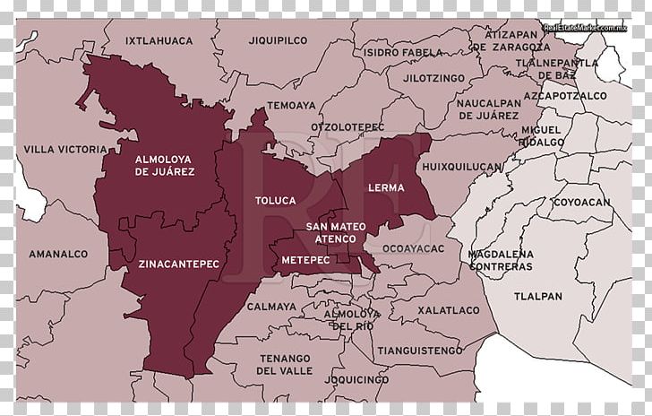
Toluca Map Municipio De Metepec Elevation PNG
. The Toluca Map Municipio De Metepec Elevation PNG has a transparent background, is 454.20 KB and has a resolution of 1024 x 657 pixels.
Elevation
History
Location
Map
Metepec
Mexico
Mexico State
Municipio De Metepec
Toluca
Topographic Map
Travel World
Velas Vallarta
Wikipedia
World
Toluca Map Municipio De Metepec Elevation PNG
Free Download
(454.20 KB)
1024 x 657
454.20 KB
ryann2k1
Editorial Use
Edit PNG
AI Background Remover
You might also like...
Map
Navigation
Treasure Map
Geography
Google Maps Logo
Travel
Location
Cartography
Pirate Map
Antique Map
Map Pin
Location Marker
Google Maps
Location Pin
Fleur De Lis
World Map
Map Icon
Travel Planning
Digital Map
Adventure Map
Old Map
Location Services
Location Logo
Direction
Cartographic Design