User pstrhtwm uploaded the image
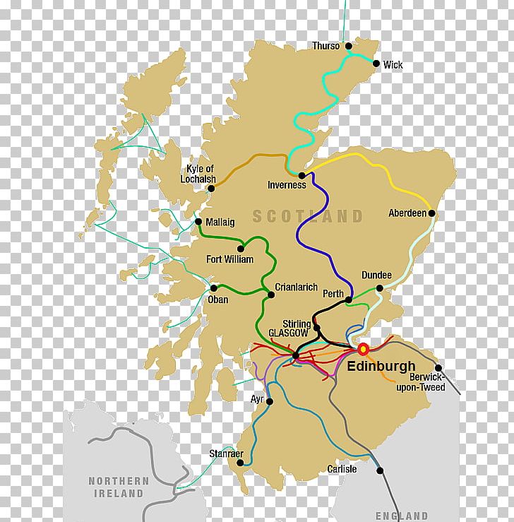
A map of Scotland, showing the major roads and highways in the country. The map is in a light beige color and shows the country's borders and major cities. The roads are in different colors, including blue, green, yellow, and red, and are arranged in a grid-like pattern. The cities are labeled with their names, such as "Thurso", "Wick", "Inverness", "Aberdeen", "Fort William", "Cranlarch", "Stirling", "Glasgow", "Edinburgh", and "Berwick upon Tweed". The map also shows the northern part of the country, including Northern Ireland and Northern Ireland.
Scotland Map Celtic Nations Isle Of Man British Islands PNG
. The resolution of this PNG file is 600 x 743 pixels and it has a file size of 171.60 KB.A map of Scotland, showing the major roads and highways in the country. The map is in a light beige color and shows the country's borders and major cities. The roads are in different colors, including blue, green, yellow, and red, and are arranged in a grid-like pattern. The cities are labeled with their names, such as "Thurso", "Wick", "Inverness", "Aberdeen", "Fort William", "Cranlarch", "Stirling", "Glasgow", "Edinburgh", and "Berwick upon Tweed". The map also shows the northern part of the country, including Northern Ireland and Northern Ireland.
Scotland Map Celtic Nations Isle Of Man British Islands PNG
You might also like...