categories
logos
calendar
log in
sign up
Categories PNG's
Famous PNG Logos
Events Calendar
Popular PNG's
Newest PNG's
PNG's by Color
AI Background Remover
AI Image Editor
Help / FAQ
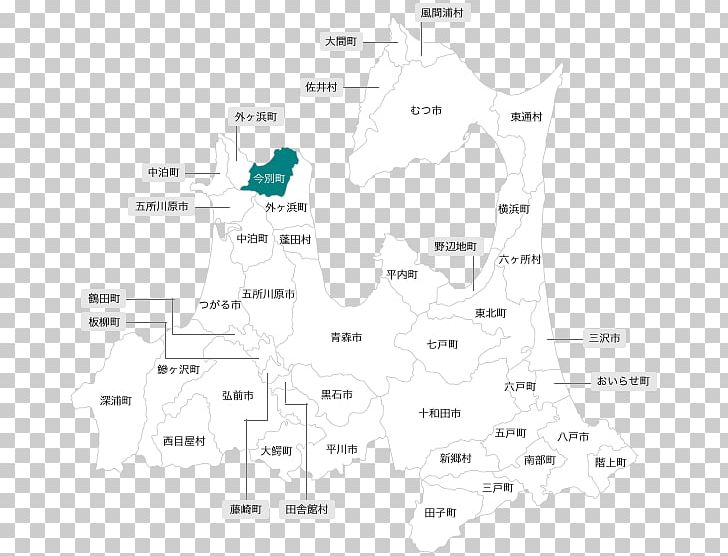
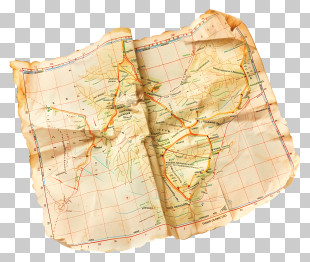
User Xio38 uploaded the image
Aomori Prefecture Diagram Map Angle PNG
. The Aomori Prefecture Diagram Map Angle PNG has a transparent background, is 59.17 KB and has a resolution of 596 x 560 pixels.
Angle
Aomori Prefecture
Area
Diagram
Imabetsu
Line
Map
Travel World
Aomori Prefecture Diagram Map Angle PNG
Free Download
(59.17 KB)
596 x 560
59.17 KB
Xio38
Editorial Use
Edit PNG
AI Background Remover
You might also like...
Map
Navigation
Treasure Map
Google Maps Logo
Geography
Travel
Location
Cartography
Location Marker
Map Pin
Pirate Map
Google Maps
Travel Planning
World Map
Route Planning
Location Pin
Antique Map
Digital Map
Map Icon
Map Design
Navigation Tool
Adventure Map
Location Services
Location Logo
Direction